Field of View in Field Spectroscopy: Why it Matters (and what you might be missing)
In field spectroscopy, field of view determines the spatial footprint of a measurement and directly influences spectral mixing, directional effects, and validation accuracy.
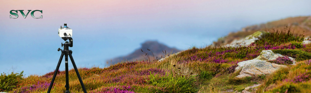
Field spectroscopy gives us extraordinarily rich spectral detail about Earth’s surfaces, but there’s a deceptively simple technical parameter that often controls whether those measurements are meaningful: the instrument’s field of view (FoV). FoV — the angular extent of ground the spectrometer “sees” — determines the spatial footprint of each measurement, and it sits at the interface between instrument optics, sampling strategy, and the real, messy world we measure. Getting FoV wrong can bias results, hide important sub-pixel variability, and create mismatches between ground truth and airborne or satellite data that you’re trying to validate.
For practical guidance and measured examples of how FoV shapes real-world observations, see the Natural Environment Research Council (NERC) Field Spectroscopy Facility discussion on instrument fields of view and directional response.
What does field of view control in field spectroscopy?
At a technical level, FoV sets the area on the ground that contributes to the measured radiance or reflectance. A narrow FoV can isolate small targets and reduce contamination from adjacent materials; a wide FoV averages over a larger area and so mixes contributions from multiple materials and viewing angles. Crucially, the FoV interacts with distance (measurement geometry), optics (aperture, foreoptic), and surface bidirectional reflectance properties — so the same instrument may “see” very different effective footprints in different conditions.
Instruments’ directional response functions and practical FoV measurements (not just their nominal specs) are covered in the white paper by Mac Arthur, MacLellan and Malthus, which shows how real instrument response differs from simple textbook cones.
How does FoV affect heterogeneous surface measurements?
Many natural surfaces are heterogeneous at scales smaller than an instrument’s footprint — think mixed vegetation patches, soil clods and litter, or rock and moss interspersed on a slope. When spectrometers average over a heterogeneous scene, spectral signatures become mixtures of the components. That mixture complicates simple interpretations (for example, a vegetation index could be damped by bare soil in the footprint) and makes comparisons with high-resolution imagery or lab spectra fraught unless you explicitly account for the sampling footprint. Field protocols that ignore FoV-driven mixing risk
systematic bias: what you record as “the field” may be a weighted average of many micro-environments rather than the intended target. Mac Arthur et al. provide experimental examples and methods to characterise effective FoV and the resulting mixing, which can inform sampling design (e.g., replicate measurements with different viewing heights, or use smaller-spot foreoptics where available).
Non-Uniform Surfaces and Directional Effects
Even where a surface is compositionally uniform, geometric non-uniformity (roughness, tilting leaves, small-scale topography) introduces directional reflectance effects. The bidirectional reflectance distribution function (BRDF) means that radiance depends on both illumination and viewing geometry. A spectrometer’s FoV and directional response determine which parts of a non-uniform surface dominate the signal — for example, a wide FoV may include specular highlights or sunlit canopy elements that a narrow FoV would exclude, changing the apparent spectrum. Because BRDF effects vary with wavelength and scattering regime, FoV-driven directional sampling can introduce wavelength-dependent biases that look like real spectral differences but are actually geometric artifacts. The NERC Field Spectroscopy Facility materials discuss how directional response and FoV combine to shape the measured signal and recommend measurement geometries and documentation practices to reduce ambiguity.
Why does field of view matter for satellite validation?
Document your geometry. Record instrument FoV (nominal and measured if possible), sensor height, target distance, sun zenith and azimuth, and any foreoptic used. These parameters are essential for interpreting measurements and for reproducing results.
Match scales. When validating airborne or satellite scenes, try to match the ground footprint to the pixel scale (or at least understand how footprints differ). If you can’t match scales, collect multiple point samples across the larger pixel footprint and report variability, not just means.
Consider foreoptics and replication. Use smaller-spot foreoptics if the target is small or highly heterogeneous, and take multiple measurements at different offsets/heights to characterise mixing.
How can FoV errors bias spectral data?
Because FoV influences both the spatial mixing and directional weighting of a measurement, data processing should incorporate that uncertainty. Report footprints, replicate statistics (mean, SD), and where possible correction or modelling choices used to account for BRDF and mixed pixels. When building spectral libraries intended for broader
use, include metadata describing FoV, measurement geometry, sensor model and any foreoptics — otherwise end users can misapply spectra to mismatched scales or viewing geometries.
Applying FoV in Optical Device Design
The NERC Field Spectroscopy Facility research demonstrates an approach for quantifying an instrument’s effective FoV by adapting the CIE technical standard methodology for characterizing luminance and applying this methodology to field spectrometers. Their work sheds light on the sampling strategies employed by common spectroradiometry instruments and suggests when alternative optics or measurement strategies are warranted.
There are different strategies for optical device design to compensate for factors impacting field of view, including heterogenous sampling surfaces, directional effects, and cross-instrument alignment. All solutions employ some software-based algorithmic averaging at some point, as well as physical adaptations like optical bench design, and collection and transmission methods. Spectra Vista Corporation devices, like the HR-1024i, address these FoV concerns with designs that house multiple detectors in the same housing and which emphasize throughput by:
- Employing a single fore-optic input which ensures the scene geometry is identical for all detectors.
- Calibrating co-aligned optical axes for each centering the field of view across detectors
- Designing for a FoV to be uniform, symmetrical and conical for consistent coverage.
- Capturing overlap data for each detector and using software to match and merge that overlap data avoiding any discontinuity or perceptible stitch points
Conclusion — FoV is a First-Order Sampling Decision
Field spectrometers measure photons that have already interacted with a complex scene. The instrument’s FoV tells you which photons you actually collect, and therefore it’s a first-order determinant of data quality and interpretability. Heterogeneity and non-uniform surface geometry make FoV central to experimental design and to the chain linking field measurements with remote sensing products. The NERC Field Spectroscopy Facility white paper by Mac Arthur, MacLellan and Malthus is a practical, instrument-focused resource that demonstrates how to measure and think about FoV and directional response; their work is a useful starting point for any practitioner wanting to move from “I took a spectrum” to “I understand what my spectrometer actually saw.”
Are you ready to validate your sampling strategy for an application in field spectroradiometry? Contact SVC to schedule a demonstration to test your methodology and see first-hand how SVC delivers reliable, consistent data that you can trust.
Practical Checklist
- Record nominal and measured FoV
- Document sensor height and foreoptic
- Match ground footprint to pixel scale
- Replicate measurements across offsets
- Report mean and variability, not just averages
References & Further Reading
Mac Arthur, A.; MacLellan, C.; Malthus, T.J., The Fields of View and Directional Response Functions of Two Field Spectroradiometers (white paper / discussion; NERC Field Spectroscopy Facility / University of Edinburgh).
NERC Field Spectroscopy Facility — Training and resources (tutorials on field spectroscopy, FoV calculator and best practice).